


About a half-mile north from the entrance to Bodie Island Lighthouse, there’s a highway sign with the headline reading Port Ferdinando. Since traffic is moving at 55-65 mph along that stretch of road, stopping to read the sign is difficult and probably not safe, so here’s the text.
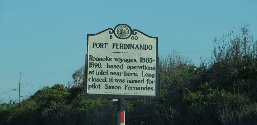
“Roanoke voyages, 1585-1590, based operations at inlet near here. Long closed, it was named for pilot Simon Fernandes.”
It’s a brief entry and only hints at the full story to be told.
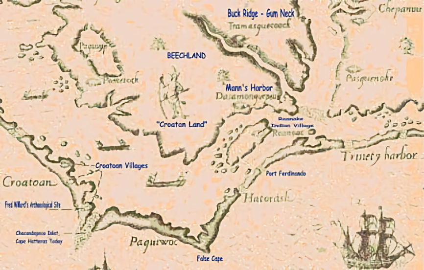
Although there is no evidence of it now, at one time, there was an inlet where the sign is located. The inlet is clearly indicated on two maps created at the time of the Lost Colony. John White’s 1585 map shows the inlet; the White-DeBry of 1590 also indicates an inlet just to the south of Roanoke Island.
The inlet was named for the Lost Colony navigator Simon Fernandes. In the play The Lost Colony, Fernandes is depicted as untrustworthy and somewhat the villain. Historically, though, it is known that he was a loyal retainer of Sir Walter Raleigh’s household and fought heroically for the English during the time of the Spanish Armada.
There is a letter from Captain Ralph Lane, the military leader, of the first expedition, to Sir Walter Raleigh describing the inlet.
The letter begins, “Thys other [inlet] called ye FerdyNando hathe a barre also but at xij foote vppon the same at hyghe water…”
In translation, what Lane wrote is, “This other [inlet] called Ferdinando has a bar also but at 12 foot upon the same at high tide…” meaning that, at high tide, the depth of the bar is 12’. He goes on to say that the bar is very narrow and that the water quickly deepens to “… iii (3), iiii (4), and v (5) fathom water…” or 18’-30’.
The inlet was vital to the colonist’s survival. This was a time of intense rivalry with Spain for dominance in the New World. Concerned that the Spanish would attack the colony, the English took steps to repel any attempt to dislodge them. Lane indicated there was a fort at the inlet, and evidence exists to support what he wrote.
The Spanish didn’t come to the location until 1588, and when they arrived, the colony had already been abandoned. When they got to the inlet, they reported finding barrels buried in the sand that would have been used to collect rainwater. The barrels were just inside the inlet mouth. When John White returned in 1590, hoping to find his daughter, granddaughter, and the rest of the colonists, he also reported finding the rain barrels.
That’s not all the Spanish reported finding.
Documents suggest that the Spanish also found considerable evidence of a well-fortified position. They were searching for the English colonists, and according to their reports what they found at Port Ferdinando was a “Varadero”, or shipyard in addition to the water casks. That would seem to indicate a considerable force was housed at the fort.
At the time that The Lost Colony was trying to establish itself, there were apparently two inlets leading directly to Roanoke Island. Dr. Stanley Riggs, a well-respected shoreline geologist and now Geology professor emeritus at ECU wrote a white paper with other coastline geologists in 2008. Titled “Past, Present and Future Inlets of the Outer Banks Barrier Islands, North Carolina,” the report included a number of inlets past and present indicated on a map. Most of the inlets no longer exist.
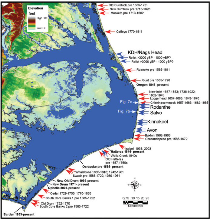
On the map, Roanoke Inlet is directly across from Roanoke Island, as Fernandes and White reported in their first survey of the area. To the south, there is a Gunt Inlet. Gunt Inlet is undoubtedly what Lane and White called Port Ferdinando. The shift in the name probably occurred when English settlers returned to Roanoke Island in the late 17th century, 100 years after the Roanoke Colony had disappeared into the wilderness. Over that period of time, names were forgotten, and maps were lost, so a new name would have been created for the inlet.
Riggs and the other authors of the white paper believe the inlet remained open almost to 1800. We do know that John Lawson, an English writer and explorer who traveled extensively through North Carolina, recorded an inlet at the location in 1706.
As more is learned about the first attempt by the English to colonize the New World, the picture of what was happening becomes increasingly complex. A fortified inlet now lost to the shifting sands of the Outer Banks is but one more part of the mystery of the disappearance of the Lost Colony of Roanoke Island.