


From Carova to Ocracoke, the Outer Banks is about 125 to 130 miles beautiful beaches. That’s what we’re known for—our beaches, and deservedly so. They are among the finest to be found anywhere.
But nestled among the 130 miles are some surprising places to visit that are certainly the Outer Banks but give a bit of a different feel to what may be a traditional way to view the area.
There are quite a number of snippets of different to choose, but here are four to start the conversation.
The Old Oregon Inlet Coast Guard Station
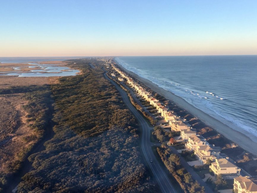
Crossing the new Marc C. Basnight Bridge from the north, it’s impossible to miss this imposing wooden structure from the sand dunes.
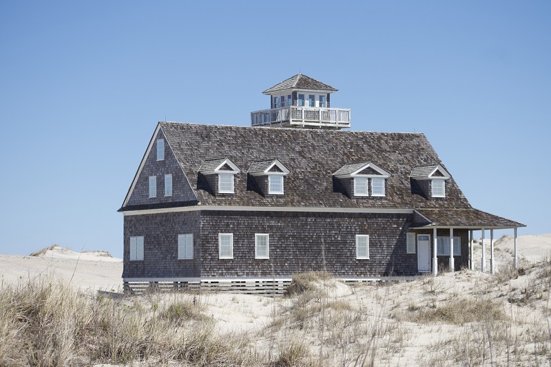
Founded in 1848, it wasn’t until the 1870s that the Lifesaving Service actually got serious about saving the lives of shipwrecked mariners. What stands at the site today is actually the third building that was on the south side of Oregon Inlet.
The first building was completed in 1874, but was abandoned to shifting sands and a migrating inlet in 1888. The second building was 400’ to the west and survived until 1897 when a storm destroyed it.
The Lifesaving Service, which became the US Coast Guard in 1915, moved quickly and by February of 1898 had a new building in place. That is the building that is there now, although it was extensively renovated in 1934 and then enlarged in 1979.
As Oregon Inlet continued to migrate south, the building was abandoned in 1988 and replaced by the new Coast Guard on the north side of the inlet.
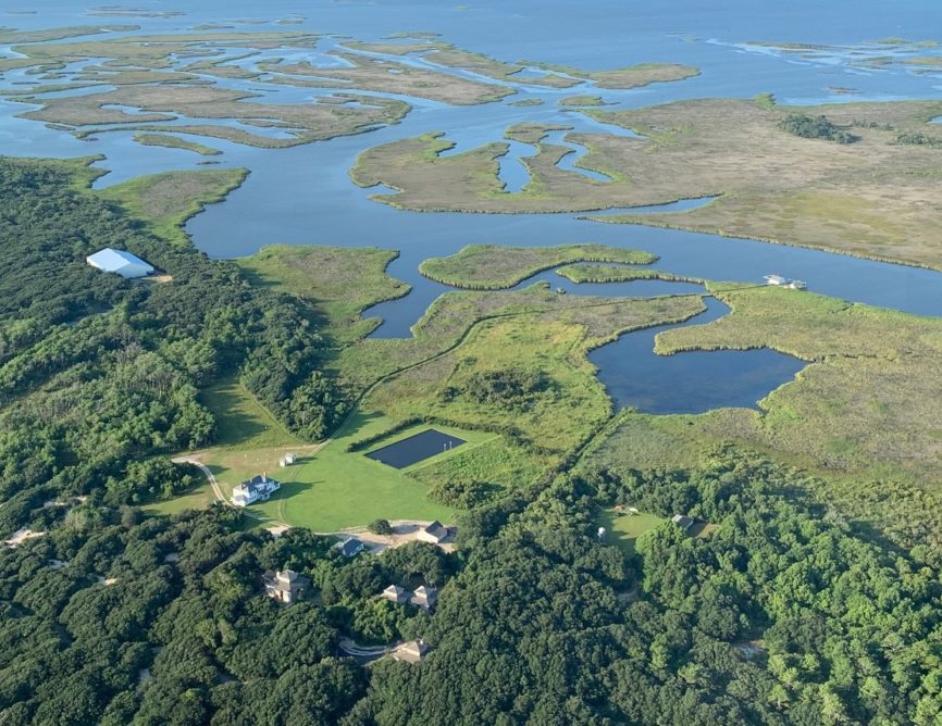
The building is remarkable and wonderful to observe. Look but do not go inside—entry is not permitted. What is really worth checking out, though are the dunes surrounding the building.
It is a very extensive dune system that has grown up, partially because there is a groin on the south side of the inlet to stop its migration. The groin has captured sand over the years and Outer Banks winds have done the rest.
There is a parking lot on the east side of NC12 at the south end of the bridge. From there there are a number of trails that lead building and sand dunes.
Wander through the dunes to the point where Oregon Inlet and the Atlantic Ocean meet. The forces at work are amazing. Check out how much boat traffic passes through the Inlet.
Take lots of pictures.
Pear Pad Beach, Fort Raleigh Historic Site, Roanoke Island
This is a mostly unknown but great little spot on the north end of Roanoke Island. What is particularly nice about it is the National Park Service seems to be in agreement with a lot of locals about how perfect this little beach is for a picnic or a dip in Roanoke Sound. This past year they improved the parking and put a short but very nice short trail to the beach.
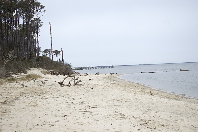
It’s off the beaten track but not difficult to find. Take Business US 64 through Manteo and keep going to Fort Raleigh Road, which leads to The Lost Colony.
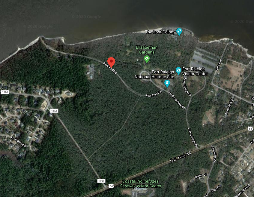
But don’t go that far down the road. Turn left on National Park Drive then in about 600’ left again on Pear Pad. Got to the end of Pear Pad and there’s a nice small parking lot.
Don’t worry about getting lost. These are the only roads at the site.
Jockey’s Ridge State Park, Nags Head
Jockey’s Ridge is generally considered the largest sand dune on the East Coast, so that’s what gets all the press. Take a little hike to the soundside of the massive dune and there’s a whole new world.
Driving along the Bypass and viewing the dune, it looks like a world of parched, barren sand. And the flanks of the dune do not have much growing on it at all.
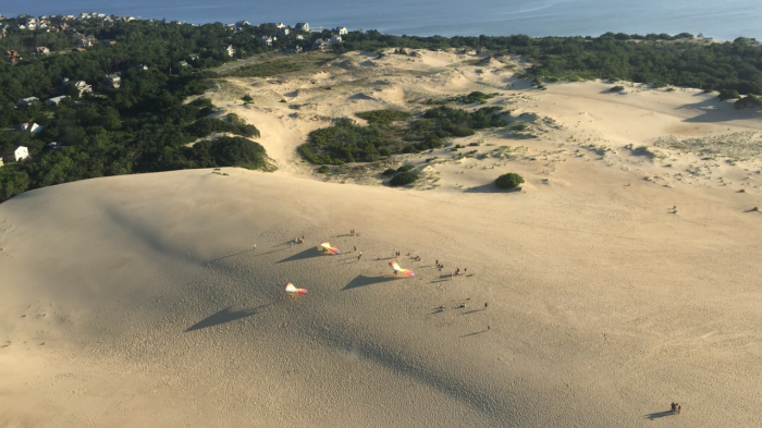
On the other side of the dune, though, protected from the salt winds of the ocean, a small but dense maritime forest has been born.
It’s easy to get to—simply follow the nature trail to the sound, turn left, which is south and walk along the beach.
That dense forest is a classic maritime forest—small but real.
Pine Island Trail
This is one we’ve written about before but it’s so classic Outer Banks that it’s hard not to return to it.
By classic, we mean back when migratory waterfowl flocked by the 100s of thousands to Currituck Sound and the rich rich hunters came every year to bag a few dozen duck or geese.
On the south end this trail begins at the soundside parking lot on the north end of the Sanderling. On the north end, it begins behind Pine Island Racquet Club.
The trail is a two-and-a-half mile packed earth trek. If it seems like it was a road at one time…well, it was. Before NC 12 was paved to Corolla, this dirt road, that was sandier at one time, was how people got to the village.
It was all part of the Pine Island Hunting Club and there was a guardhouse at the south end. Without permission, entry was not allowed.
There are two observation towers along the trail. Well worth checking out.
Insect repellant is a necessity in the summer.